There is considerable variation in the depth of the sea bottom within the area covered by this Atlas (see MAP Methods). Several trenches over 200m deep lie close to the coast in the Inner Sound, east of Barra and in the Sound of Jura. Beyond the shelf edge and slope west of the Hebrides, depth extends below 2,000m. Offshore, the sediments are varied (see references to geological works) and there are areas of bedrock, such as the Stanton Banks, where tidal currents are strong.
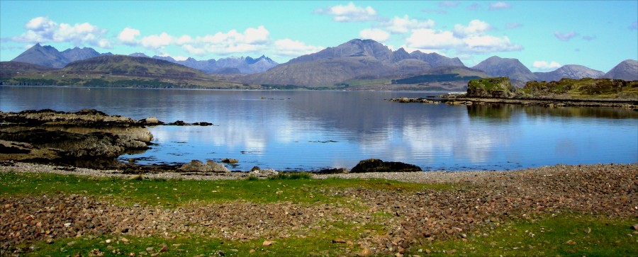
The coastline is convoluted. Many habitats are found, possibly all those present in the British Isles. They range from the extremely exposed Atlantic coasts, generally rocky as on St Kilda or sandy as on the west coast of Harris, to the many (Smith 1984c, 1987b) completely sheltered inlets and lagoons. These have a complete range of salinity, the intermediate ones in the Uists being of particular significance (Nichol, 1936; Waterston et al., 1968, 1979). There are also cliffs, a variety of other rocky shores, boulder beds, shingle, sand, sand dunes, muddy and gravel shores: the heads of sea lochs where fresh water flows over gravel and pebble beds (some being sheltered but others exposed to storm wave action coming up the loch).
Inshore, beds of maerl and Zostera marina are common. The largest maerl beds are in the outer Loch Carron area and near Arisaig and are exposed at extreme low tides. Salinity ranges from that of the open ocean through brackish to almost fresh water. Fresh water overlies salt in the halocline conditions of some lagoons, such as Loch Obisary (Dipper et al., 1980, 1987) and river mouths. Some enclosed waters, such as Linne Mhuirich, have extremes of temperature with possible freezing in all but the mildest winters and high temperatures in summer.
There are many tidal rapids, ranging from small waterfalls flowing from high-level lagoons, through larger rapids at the mouths of large lagoons, to current areas at the sills of sea lochs. More open channels where tidal flow is considerable include the Gulf of the Corryvreckan. The sea lochs in many cases have steep underwater cliffs, and boulder bed or mud slope sides with calm muddy floors which may be over 100m in depth. Those with shallow sills and/or constrictions at the entrance and perhaps also further up, have good tidal flow and flushing rate and are concomitantly rich in marine life. Those without such advantages, of which Loch Sween is the best known, are poorer.
A full range of water quality is present, from the clarity of St Kilda to the murkiest parts of the Clyde and Lough Foyle. The region is, in general, relatively little affected by human activity. Around the major conurbations and a few others, there are local effects of pollution by chemicals etc. (such as around fish farms) and there is sea bottom disturbance by dredging for scallops and other shellfish.
Over the last 5-10 years, tourism has increased and adverse pressure from this is locally becoming very noticeable. In particular, sheltered bays with road access which had diverse fauna and flora have fallen prey to development, including marinas, and have become distressingly barren. A worrying development of fish farms has been the use of chemicals to kill fouling organisms, which received considerable publicity resulting in less usage. Recently a problem with mussel farms, previously thought benign, has come to light. Although other places have not yet been examined, in Loch Creran it is clear that the farmed mussels have produced so much spat that these have developed into thick shore mussel beds, killing off much of the previous diverse fauna and flora.
Hydrography appears to play a considerable part in the distribution of species. The Clyde is a sea apart, with a slow flushing rate, which possibly has caused what now can be perceived as a relatively depauperate area. Water enters from the Irish Sea and leaves through the North Channel. Lusitanian Atlantic water (and occasionally Gibraltar water) comes up the west coast of Ireland and round Donegal. Most is deflected northwards by Malin Head and meets the water coming north through the North Channel along the Islay Front. This northerly flow continues west of the Outer Hebrides and up the Minches where there is a bottleneck at the Isle of Skye resulting, apart from near Skye, in a diminution of diversity to the north.

Copyright © Shelagh Smith & Julia Nunn
